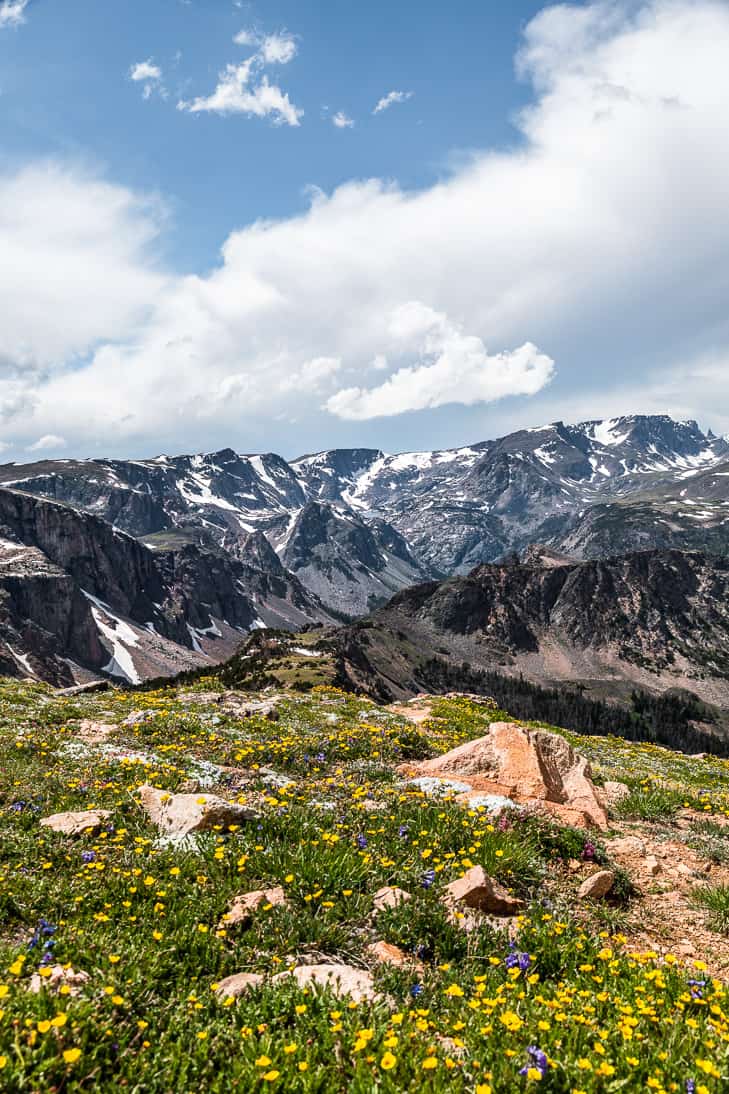
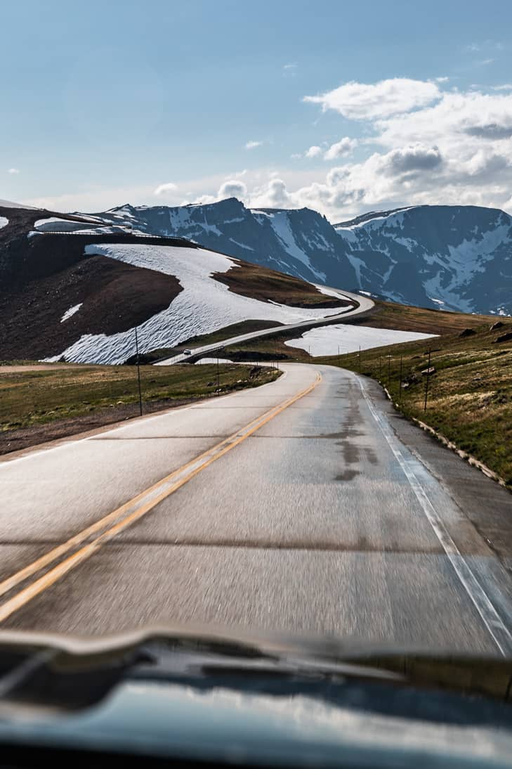
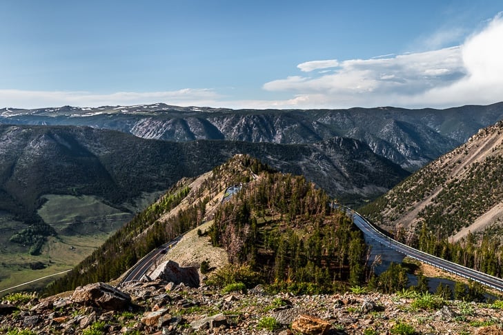
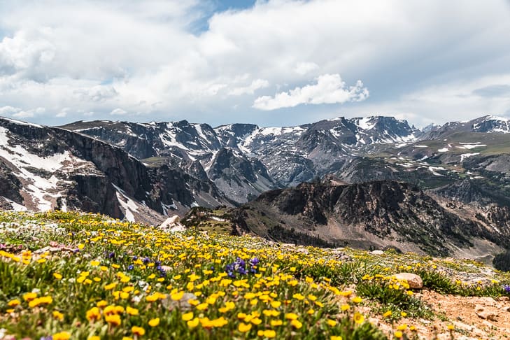
I’ve lived in Montana my whole life, but I had never heard of this popular scenic drive. To be fair it’s quite a distance from where I grew up, but we were so taken with the area we’re planning another trip already. It’s a stretch of 68 stunning miles of constant scenery. You climb up to the highest point of 10,947′ at Beartooth Pass and the mountains in every direction are amazing. There are lots of hikes along this road as well as countless pull-offs for sightseeing. In fact, we couldn’t find much information about the different hikes, so we bought a map in the town of Red Lodge and just picked some at random.
Everything you need to know about Beartooth Highway Scenic Drive
Distance – 68 miles Elevation Gained – 5,000′ through switchbacks up to Beartooth Pass Highest Elevation – 10,947′ at Beartooth Pass Time Needed – 3+ hours to complete the road, more if you like to take a lot of photos. We spent about 4 days here camping, hiking, and photographing along the road traveling over certain parts many times. Bathrooms – are very limited with 1 at the first main lookout – Rock Creek Vista Point looking over Hell Roaring Plateau. And the second one wasn’t until the Island Lake campground or Top of the World Store on the Cooke City side. There’s nothing available through the middle section, so definitely plan ahead the best you can! Open & Close Dates – The road is generally open from the Saturday of Memorial Day weekend to early October, weather depending. You can check out their Facebook page for up-to-date information.
And now onto storytime
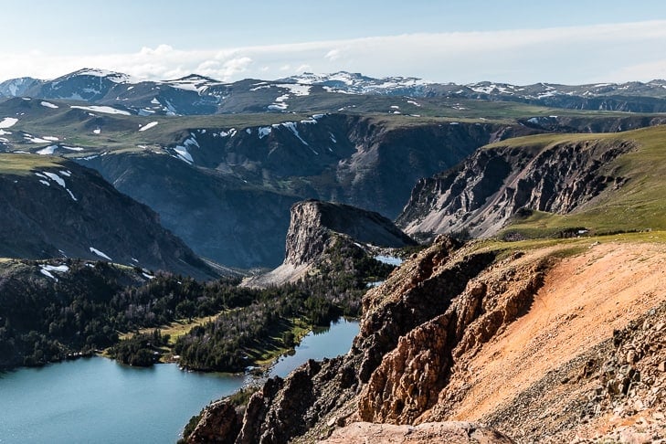
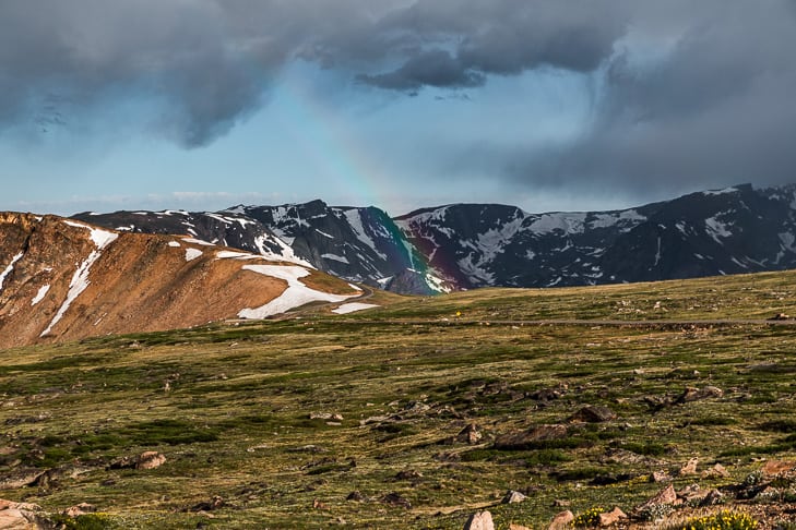
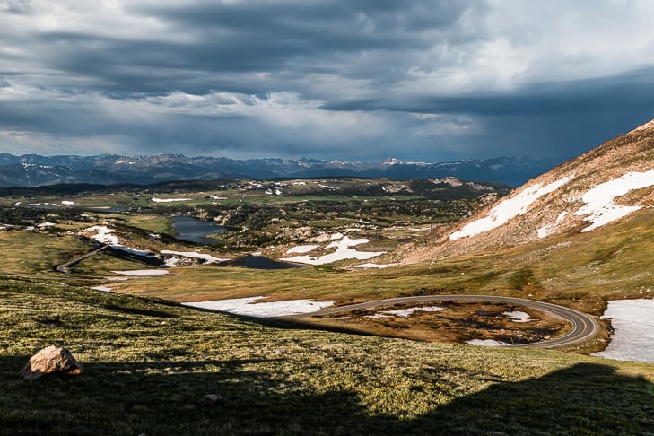
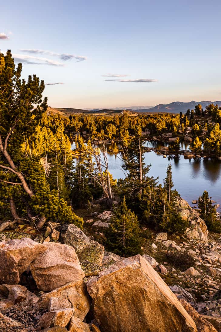
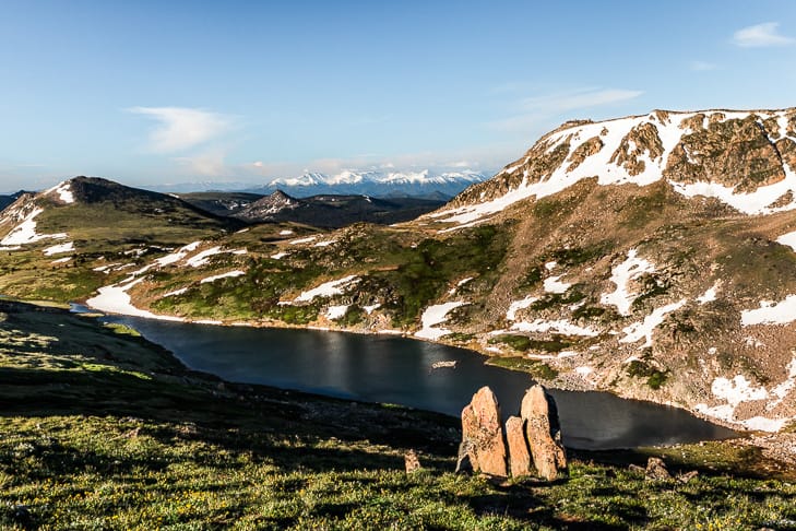
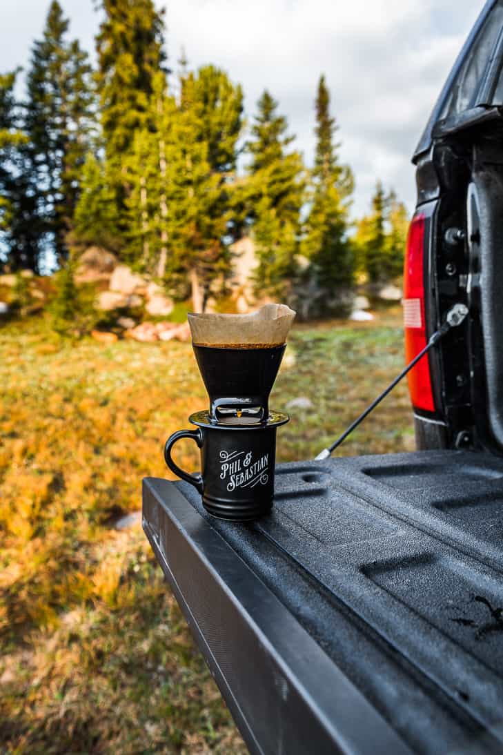
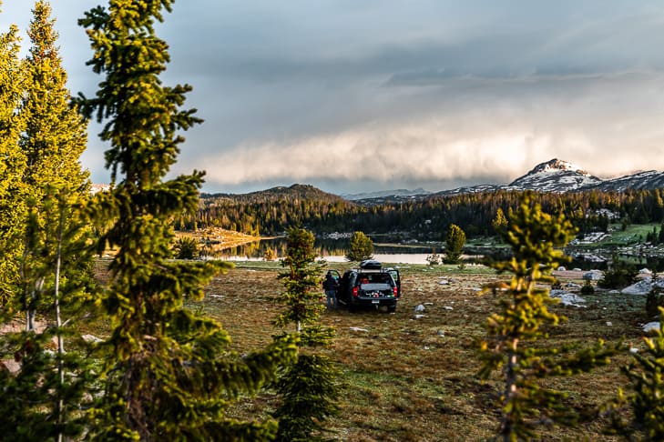
We spent just shy of 4 days coming from Red Lodge to Cooke City before heading into Yellowstone National Park. But you can take whatever route works best for you. In fact, most people come from Yellowstone and start their journey from Cooke City. I would recommend getting on Google Maps and taking a look at the route between Red Lodge and Cooke City. That will help you determine what works best for you. On the Red Lodge side, we took a bumpy dirt road into the Glacier Lake trail. That one was extra stunning early in the season with some icebergs still floating around. From there a storm moved in and we drove the Beartooth Highway right after a thunderstorm. It was incredibly stunning with the dark storm clouds and the sun breaking through. That night we stayed in the Island Lake Campground. We were both suffering from a touch of altitude sickness so we wanted to descend in elevation a bit. We live at around 3,500′ above sea level and routinely hike between 7,000-10,000′. But since this was early in the summer, we weren’t used to being up high. And since both of us had headaches and were feeling queasy, we decided to get a good sleep a bit lower that night in the campground. The next day we were feeling good again and headed back up to Beartooth Pass to photograph the sunrise. From there we parked at the Gardner Lake parking lot and hiked down into the lake. We were planning to do the loop around Tibbs Butte that starts from the lake, but once we got a good look at Tibbs Butte we decided to do an off-trail scramble instead. This turned out to be one of our favorite hikes on this trip. The views were so incredible in every direction! Tibbs Butte is just over 10,000′ so we were both sucking air but at least we had recovered from the other effects of altitude sickness. That evening we set up for a sunset time-lapse and made tacos on the tailgate of the truck. From there we found a ‘primitive’ dispersed camping site on Forest Service land. We slept like rocks again that night, so tired out from all the day’s adventures. And the next morning was another great photography morning before a crazy and violent thunderstorm rolled in. We were running late to get on the trail for our hike that day. But it worked out great as we waited out the intense storm in the safety of the truck. We plotted ahead looking at the map for what we might do next. Then once the storm cleared we headed into Twin Lakes. This is an easier hike than the previous ones, but there’s not much of a trail. If you have a good sense of direction you’ll find it easily by following an old ATV track down towards the lake. The main struggle is finding the right pull-off. There’s very little signage, so a map is really a must here! We really lucked out after Twin Lakes because another serious thunderstorm hit the minute we got back to the truck. So we waited it out again before we started driving for a sunset photography location. Tyler set up for another time-lapse and I made dinner on the tailgate. It was one of those nights where you’re racing against the clock. I was cooking as fast as humanly possible all the while watching a very dark storm heading my way. But I just made it in time, and we enjoyed boxed mac and cheese with fresh mozzarella, tomatoes, and basil added. It’s a version of my One Pot Caprese Mac and Cheese recipe that I make while camping. But when we’re camping I make it a bit easier with boxed mac and cheese. There’s nothing quite like a large bowl of pasta when you’re extra hungry and the rain is just pouring down! The next day dawned with another gorgeous sunrise and we headed towards Cooke City to hike the Beartooth Lakes Loop. This turned out to be quite the adventure to be sure! Even though the snow had mostly melted, the trail was mostly underwater. We didn’t know this and ended up taking a side trail to a creek crossing up higher. It’s pretty obvious this is the early-season route. But from there things got murky. A father-daughter duo behind us was on the same track, but they never made it either. We ended up following a trail that got fainter and fainter until it was just a game trail. At this point, we knew we were way off track. But we could tell things were opening up. So we wanted to get to that higher point to take a look around. When the trees broke we found ourselves at the shores of a stunning lake. The problem was, we didn’t know which lake it was! We broke out our map and still couldn’t figure out which lake we were at. There are tons of lakes in this area and based on where we were it could have been any number of lakes. So without any clear way to figure things out further, we backtracked down the creek to our crossing point to reassess things. Just to be clear we knew where we were the whole time in terms of how to get back to the truck. You never want to continue into the wilderness when you don’t have direction because it’s life-threatening. This whole time we were surrounded by more mosquitos per square inch than I’d ever seen before. Every time we stopped to consult the map, there was buzzing everywhere which made it really hard to concentrate. So despite the 90ºF heat, we both put our Gortex raincoats on along with some bug nets. It was desperately hot, but so much better than a million mosquitos! Once we got back down to the river crossing it was clear another storm was rolling in. So instead of pursuing the right trail, we made the safe decision to fast track for the truck. As we headed back we ran into the father-daughter duo from earlier in the day. Their story was even worse than ours, they just ended up wandering on spur trails all over the place. They finally had to give up and head back. So we really lucked out coming upon the gorgeous lake in the middle of nowhere. At least it felt like we somewhat got to a ‘destination’ so to speak. Looking at the map from the peace and quiet of the truck with no mosquitos, we figured out we made it to Crane Lake. There’s no official trail there, but it’s not too far from the trail to Beauty Lake. It was absolutely incredible there. We only wish we could’ve enjoyed it with about 1 billion fewer bugs! But so it goes in July. This whole debacle wasn’t super funny on the trail, but we’ve been laughing about it ever since. In fact, Tyler cut his foot on one creek crossing on the way back which really put a damper on things. It’s no fun doing first aid when a cut has been packed with mud for 2 miles! The trail was so incredibly muddy, I actually finished the hike barefoot. But all in all, we had a good time and even had a laugh by the time we gratefully reached the truck again! After our ‘interesting’ morning we headed for Yellowstone National Park. We weren’t planning on spending any time there on this trip. But we needed to pass through to get to Teton National Park. But there were some roads shut down in Yellowstone, so we ended up going from Lamar Valley all the way to Yellowstone Lake. We got to the West Thumb Geyser Basin just in time to hike it for sunset. And from there, we beelined out of the park for somewhere to camp. Heading south we found a parking lot outside of the park to park overnight. And we’ll continue the story with the West Thumb Geyser Basin soon!